
Compare the 14 places to visit in Kiama at a glance
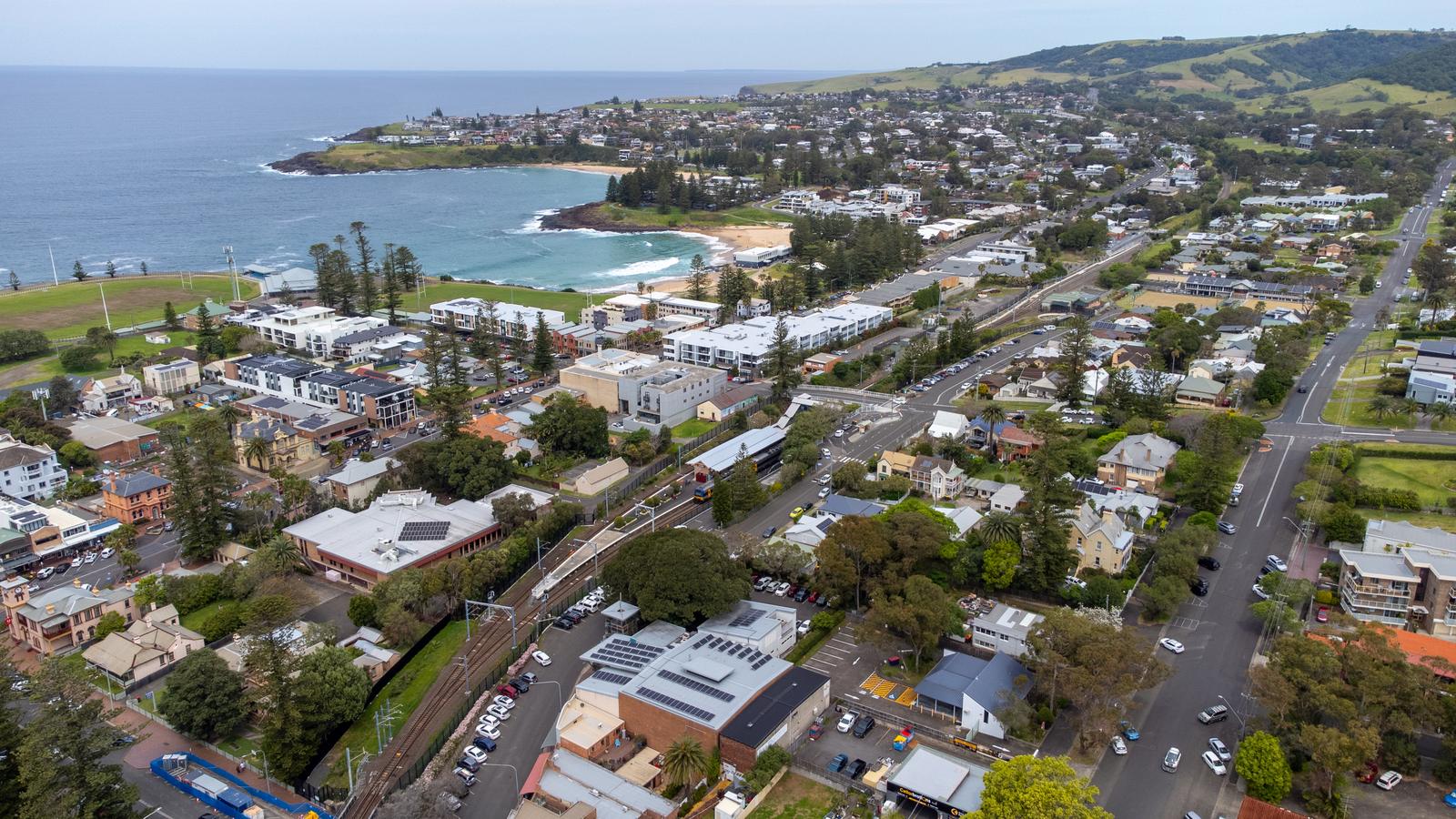
Kiama is small, but its sights are spread along about 20 km of coast and up into the green hills behind town. This list sticks to places: headlands, beaches, lookouts, a rainforest and three villages. For activities, food and events, our Explore Kiama hub has the full set of guides.
Walk and drive times below are from Kiama Ridge Waters at 2 Surfleet Place, Kiama. Traffic, parking and summer crowds add time, so treat them as a guide.
| Place | Allow | From Kiama Ridge Waters | Entry |
|---|---|---|---|
| Easts Beach | 1 to 3 hrs | 15 min walk (1.3 km) | Free |
| Little Blowhole | 30 min | 20 min walk (1.6 km) | Free |
| Kiama Blowhole | 30 min to 1 hr | 35 min walk (2.9 km) or 5 min drive | Free |
| Kiama Lighthouse | 30 min | 35 min walk (2.8 km) or 5 min drive | Free (grounds only) |
| Kiama Harbour | 1 hr | 30 to 35 min walk or 5 min drive | Free |
| Kiama Coast Walk | 1.5 hrs to a full day | Joins the track near Easts Beach | Free |
| Bombo Headland Quarry | 1 hr | 8 min drive (7 km) to Bombo station | Free |
| Cathedral Rocks | 1 hr | 9 min drive (7.6 km) | Free |
| Saddleback Mountain | 30 min to 1 hr | 9 min drive (6.8 km) | Free |
| Gerringong and Werri Beach | Half a day | 10 min drive (8 km) | Free |
| Seven Mile Beach | Half a day | 12 min drive (10.9 km) to the Gerroa lookout | Free |
| Jamberoo | Half a day | 14 min drive (11 km) | Free |
| Berry | Half to a full day | 15 min drive (20.5 km) | Free |
| Minnamurra Rainforest | 2 to 3 hrs | 25 min drive (18 km) | $12 per vehicle per day |
Hours, fees and track conditions change, so check before you go. To see where everything sits, open our Kiama map.
Start at the Kiama Blowhole on Blowhole Point
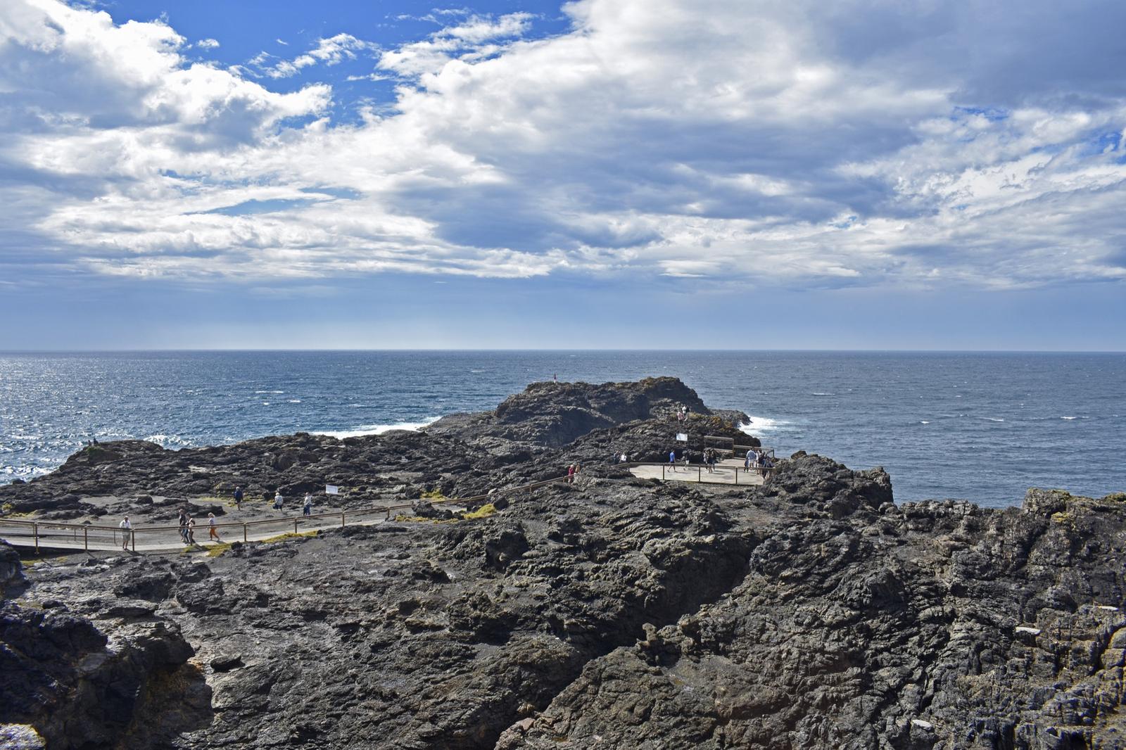
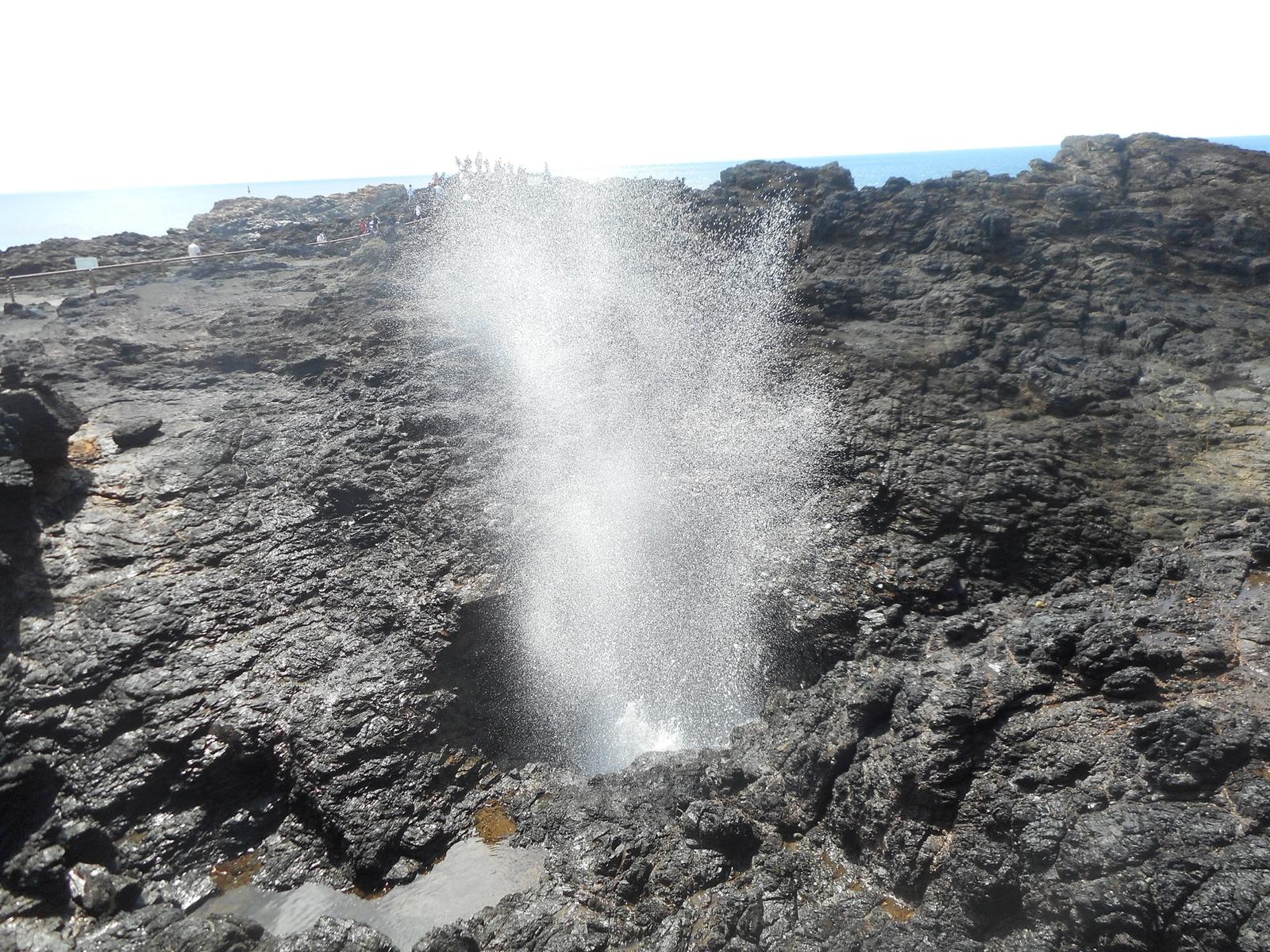
The Blowhole is the reason most people first come to Kiama. Waves push into a sea cave under the basalt headland and force water up through a 2.5-metre opening, with plumes recorded at over 30 metres. It works hardest in a south-east wind with a south-east swell, so a wild, wavy day beats a calm sunny one.
It is free and open 24 hours, with several accessible viewing platforms, a car park, coach parking and public toilets that are always open. The point is floodlit after dark. Allow 30 minutes to an hour, longer if you add the Lighthouse and the ocean pool next door.
From Kiama Ridge Waters: about a 35-minute walk (2.9 km) or a 5-minute drive. The car park fills at busy times, so come early or walk in. Read our full Kiama Blowhole guide for swell tips and history.
Kiama Blowhole
Blowhole Point Road, Kiama
Free, open 24 hours. Accessible platforms, car park, toilets and a cafe. Sprays highest in a south-east swell.
WebsiteGoogle MapsDirections: Google Maps · Waze
Walk up to Kiama Lighthouse beside the Blowhole
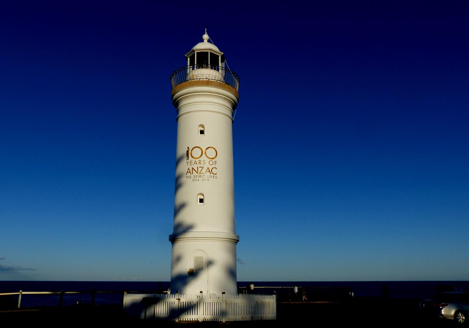
The short white lighthouse on the high point of Blowhole Point was first lit on 1 January 1887 and still guides boats into Kiama Harbour. The grounds are free to walk around, but the tower itself is closed to the public and there are no tours.
Go for the view. The Blowhole sits on the rocks below, the harbour is on the other side, and the coast runs north to Bombo. At dusk the light comes on above the Norfolk Island pines, which makes it a good last stop of the day. The Pilot's Cottage Museum next door is run by the Kiama Historical Society and opens on weekends. Check its hours before you go.
From Kiama Ridge Waters: about a 35-minute walk (2.8 km) or a 5-minute drive, using the Blowhole Point car park. Allow 30 minutes. More in our Kiama Lighthouse guide.
Kiama Lighthouse
Blowhole Point, Kiama
Active lighthouse first lit in 1887. Grounds free to walk; no access inside the tower.
WebsiteGoogle MapsDirections: Google Maps · Waze
Watch the fishing boats come into Kiama Harbour
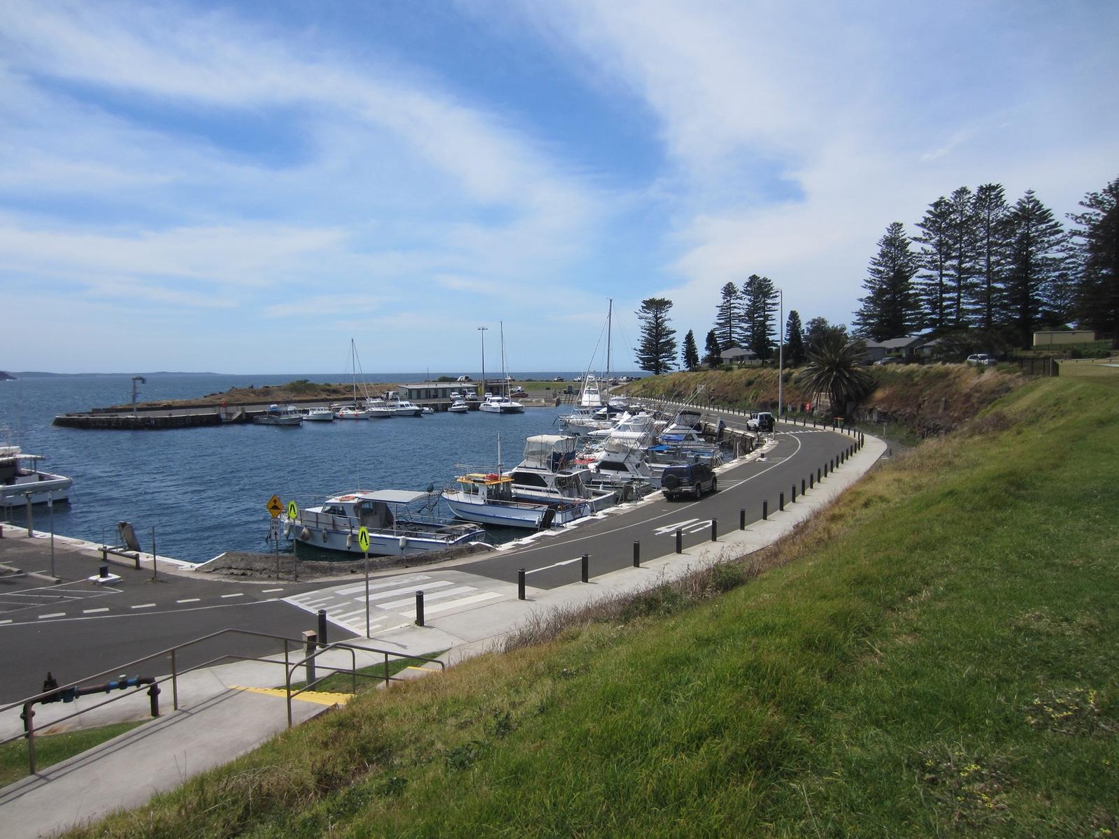
Kiama Harbour is the town's small working harbour, a stone-walled basin called Robertson Basin that opened in 1876 in the shelter of Blowhole Point. Fishing and charter boats tie up here, there is a boat ramp, and the Kiama Fisheries seafood market sells the catch on the waterfront.
It is free to visit, with a car park and a public toilet, and Destination Kiama lists it as welcoming people with access needs. Black Beach, the dark-sand beach at the edge of the harbour, is a short walk away. Allow an hour, and combine it with the Blowhole and Lighthouse, which are only a few minutes' walk across the point.
From Kiama Ridge Waters: about a 30 to 35-minute walk or a 5-minute drive to Terralong Street. See our Kiama Harbour guide for the boats, seafood and history.
Kiama Harbour (Robertson Basin)
Terralong Street, Kiama
Working harbour opened in 1876. Free, with car park, toilet, boat ramp and seafood market.
WebsiteGoogle MapsDirections: Google Maps · Waze
Catch the Little Blowhole on a north-east swell
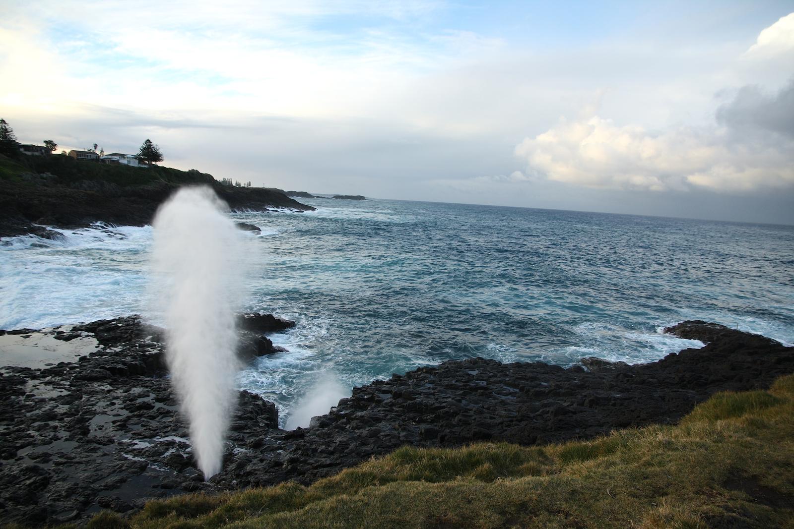
The Little Blowhole sits on the rock platform below Marsden Head, off Tingira Crescent, about 2 km south of the town centre. It is smaller than the main Blowhole, but it sprays on north-east swells and Destination Kiama says it is often more dramatic when the swell is small. When Blowhole Point is quiet, come here.
It is free and open 24 hours, with a car park, lookouts and a picnic area. The official listing says it does not cater for people with access needs, and people also watch from the rocky foreshore, so keep well back from the edge.
From Kiama Ridge Waters: about a 20-minute walk (1.6 km) or a 4-minute drive. It is the closest headland to the apartments, so it makes an easy before-breakfast walk. Read our Little Blowhole guide.
Little Blowhole
Tingira Crescent, Kiama
Free, open 24 hours. Car park, lookouts and picnic area. Sprays on north-east swells.
WebsiteGoogle MapsDirections: Google Maps · Waze
Swim at sheltered Easts Beach, 15 minutes on foot
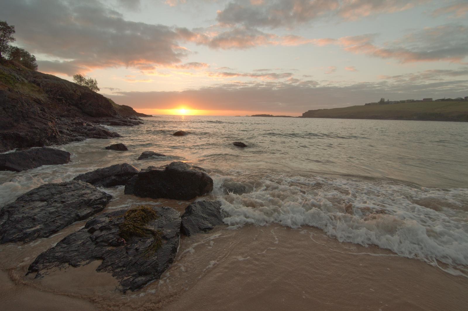
Easts Beach is the southernmost of Kiama's town beaches: about 350 m of east-facing sand between two headlands, sheltered from much of the wind and swell. BeachSafe rates it 4 out of 10 for hazard, lower than the open surf beaches, and Kiama Council lifeguards patrol it over the Christmas school holidays. Munna Munnora Creek at the southern end is a favourite with small children.
Because it faces east, the sun comes up over the water, which makes it an easy sunrise spot. Access is by steps at each end, so it does not suit people with access needs.
From Kiama Ridge Waters: about a 15-minute walk (1.3 km), the closest beach to the apartments. Check BeachSafe for conditions and patrol times before you swim. See our Easts Beach guide.
Easts Beach
Kiama Heights, south of Kiama town
Sheltered 350 m beach, hazard rating 4 out of 10. Patrolled over the Christmas school holidays.
WebsiteGoogle MapsDirections: Google Maps · Waze
Link the sights on the Kiama Coast Walk
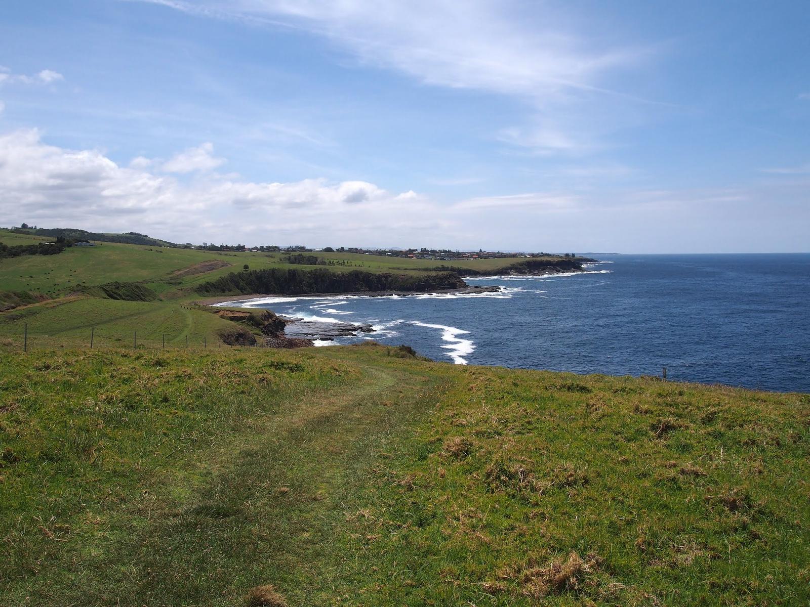
The Kiama Coast Walk ties many places on this list together. It runs about 20 km from the Minnamurra River to Werri Beach at Gerringong, in three sections, and takes 6 to 7 hours end to end. Most people pick one section.
| Section | Route | Distance and time | Places you pass |
|---|---|---|---|
| North | Minnamurra River to Kiama Blowhole | 8.5 km, 3 hours | Cathedral Rocks, Bombo Headland, Kiama Harbour |
| Mid | Kiama Blowhole to Loves Bay | 5 to 6 km, 1.5 hours | Surf Beach, Kendalls Beach, Little Blowhole, Easts Beach |
| South | Loves Bay to Werri Beach | 6 km, 2 hours | Quiet clifftops and farmland, ending at Gerringong |
Times are one way, from Destination Kiama. The walk is free. Dogs are welcome on a leash for most of it, but not on some beach sections. The Mid section passes Easts Beach, about 15 minutes' walk from Kiama Ridge Waters, so you can join it without the car. Our Kiama Coast Walk guide covers each section, and walks in Kiama has shorter options.
Kiama Coast Walk
Minnamurra River to Werri Beach, Gerringong
About 20 km in three sections, 6 to 7 hours end to end. Free.
WebsiteGoogle MapsDirections: Google Maps · Waze
Explore the basalt columns of Bombo Headland Quarry
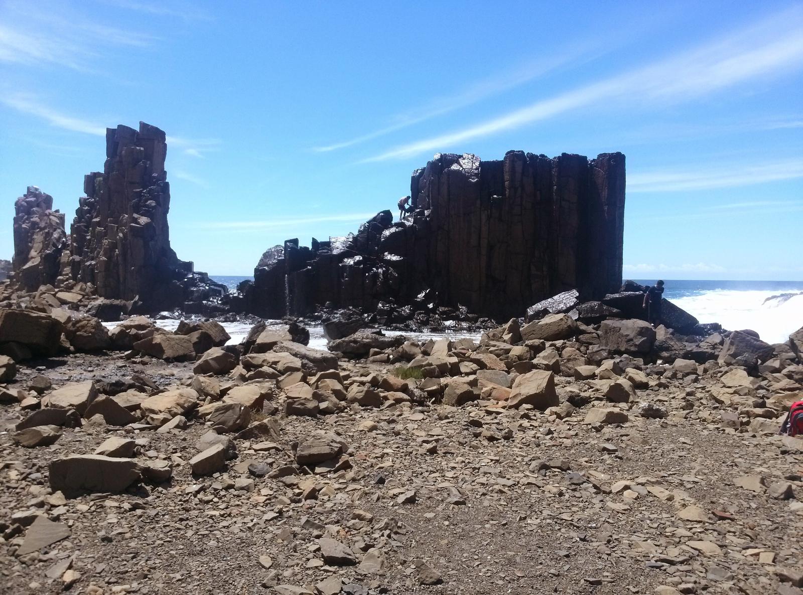
On the headland at the north end of Bombo Beach, tall grey-black basalt columns rise from a flat quarry floor beside the sea. They were exposed by blue metal quarrying in the 1880s and 1900s, according to Destination Kiama, and the sea has weathered them ever since. The site is on the NSW State Heritage Register as the Bombo Headland Quarry Geological Site.
Destination Kiama compares it to a lunar landscape and says it often turns up in television commercials and photo shoots. Sunrise is the time photographers favour. The ground is rough and loose, and the listing says it does not cater for people with access needs, so wear sturdy shoes and stay back from the water when waves break over the platform. Allow an hour.
From Kiama Ridge Waters: about an 8-minute drive (7 km) to Bombo station, then a short walk onto the headland, or about 1 hour 7 minutes on foot (5.4 km). Read our Bombo Beach and Headland guide.
Bombo Headland Quarry Geological Site
Bombo Headland, Bombo
Heritage-listed basalt columns from 1880s to 1900s quarrying. Free. Rough ground, not suited to people with access needs.
WebsiteGoogle MapsDirections: Google Maps · Waze
See the sea stacks at Cathedral Rocks
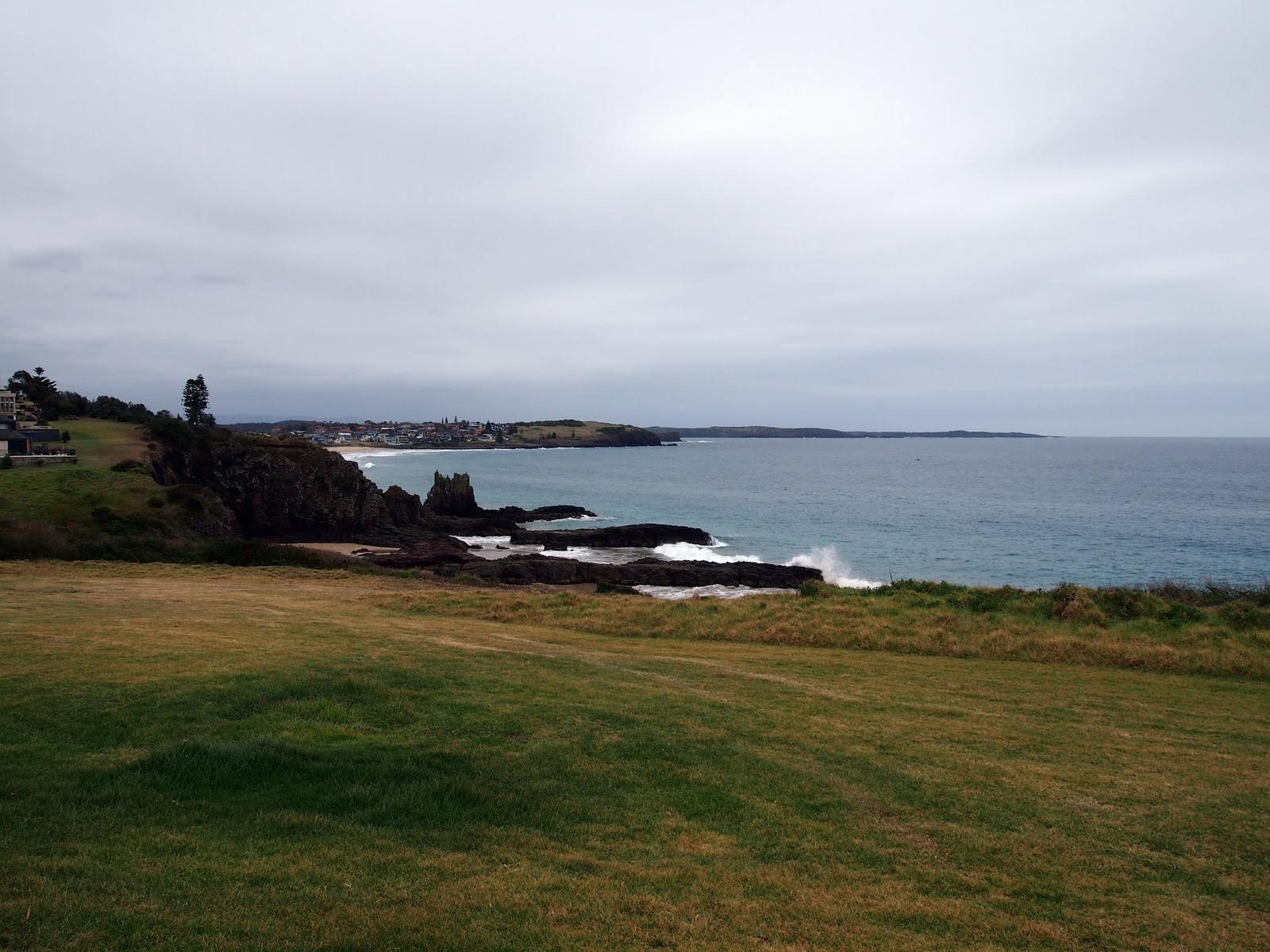
Cathedral Rocks are jagged basalt sea stacks at the southern end of Jones Beach, Kiama Downs, about 3 km north of town. Destination Kiama describes them as towering formations shaped as hard volcanic rock eroded over millions of years. The main stack stands in the surf, so you look at it rather than climb it, but there are rock platforms, a small sea cave and rockpools close to the sand.
Walk south along Jones Beach from the car park off Cliff Drive. Go near low tide in a small swell, ideally at sunrise, when the light comes from behind the stacks. Entry is free and the listing says it does not cater for people with access needs. Allow about an hour.
From Kiama Ridge Waters: about a 9-minute drive (7.6 km). Pair it with Bombo Headland, which is just to the south. See our Cathedral Rocks guide for tides and where to park.
Cathedral Rocks
Cliff Drive, Kiama Downs
Basalt sea stacks at the south end of Jones Beach. Free. Go near low tide in a small swell.
WebsiteGoogle MapsDirections: Google Maps · Waze
Drive up Saddleback Mountain for the view
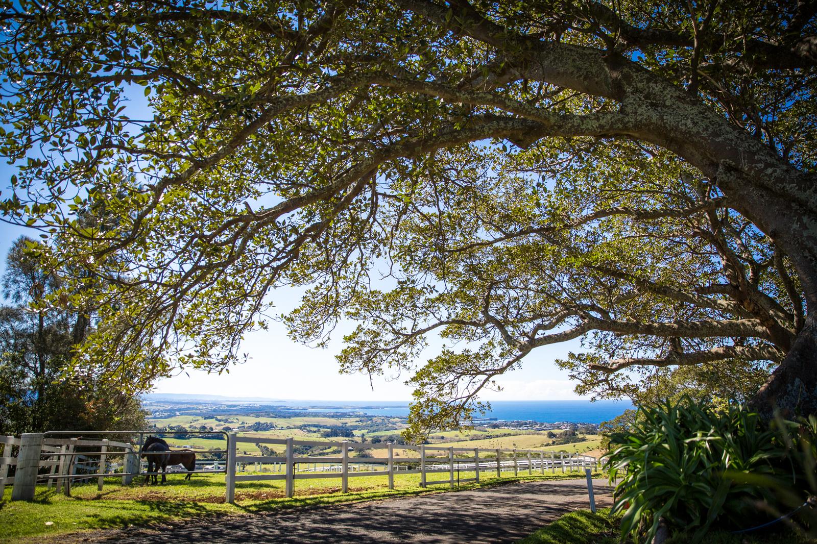
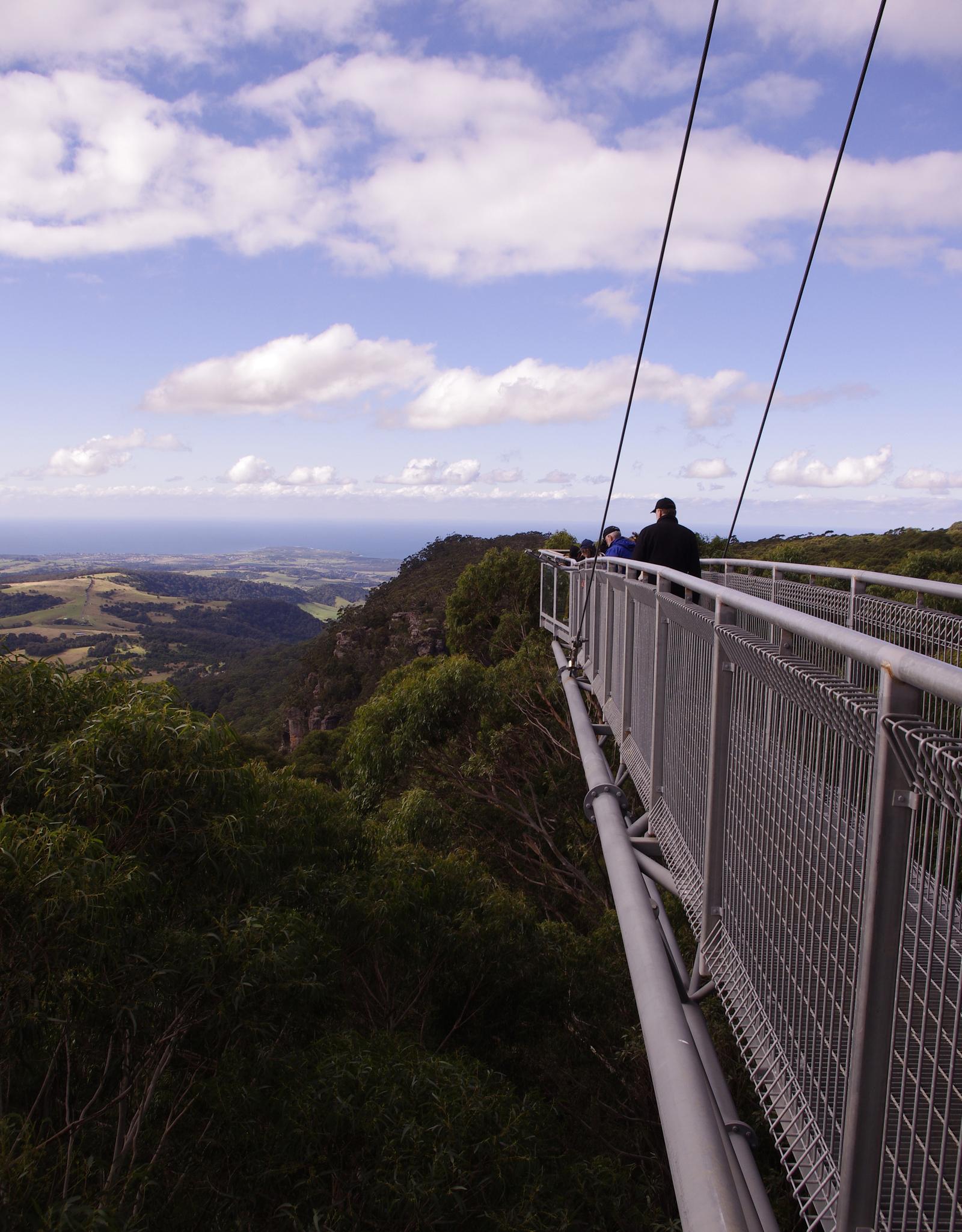
Saddleback Mountain rises more than 600 metres above sea level behind Kiama. The lookout is on Jack Cleary Memorial Drive, off Saddleback Mountain Road, about 6 km south-west of town. From two viewing platforms you can see the coast from Cronulla to Milton on a clear day, with Kiama and the farmland below.
The road climbs through dairy country past historic dry stone walls, so drive slowly and stop only where it is safe. You park at the top, and no entry fee or opening hours are published for the lookout. Allow 30 minutes to an hour. Clear mornings and late afternoons give the sharpest views.
From Kiama Ridge Waters: about a 9-minute drive (6.8 km). Read our Saddleback Mountain guide, or see more high points in Kiama lookouts.
Saddleback Mountain Lookout
Jack Cleary Memorial Drive, off Saddleback Mountain Road
Free lookout over 600 m above sea level with two viewing platforms.
WebsiteGoogle MapsDirections: Google Maps · Waze
Spend half a day in Gerringong and on Werri Beach
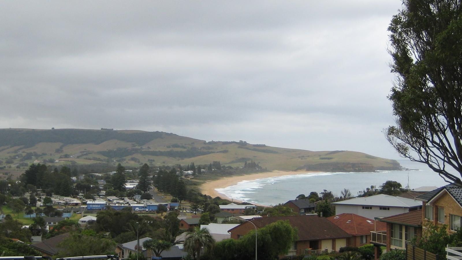
Gerringong is a hilltop village in the Municipality of Kiama, looking down over the long curve of Werri Beach. Werri Beach runs about 1.7 km from Werri Lagoon south to the Ourie Ocean Pool. Gerringong Surf Life Saving Club patrols the southern end on weekends from late September to late April, and BeachSafe rates the beach 7 out of 10 for hazard, so swim between the flags.
Fern Street has the shops and cafes. On the headland at the south end of the beach you will find the rock pools, Boat Harbour and a free whale-watching platform. Gerringong is also the finish of the Kiama Coast Walk, and the station is on the South Coast Line, one stop past Kiama.
From Kiama Ridge Waters: about an 8 to 9-minute drive (8 km). See our Gerringong guide and Werri Beach guide.
Gerringong
Fern Street, Gerringong
Hilltop village with cafes, ocean pools and a whale-watching platform.
WebsiteGoogle MapsDirections: Google Maps · Waze
Werri Beach
Pacific Avenue, Werri Beach
About 1.7 km surf beach. Patrolled at the south end on weekends, late September to late April.
WebsiteGoogle MapsDirections: Google Maps · Waze
Walk the long sand of Seven Mile Beach from Gerroa
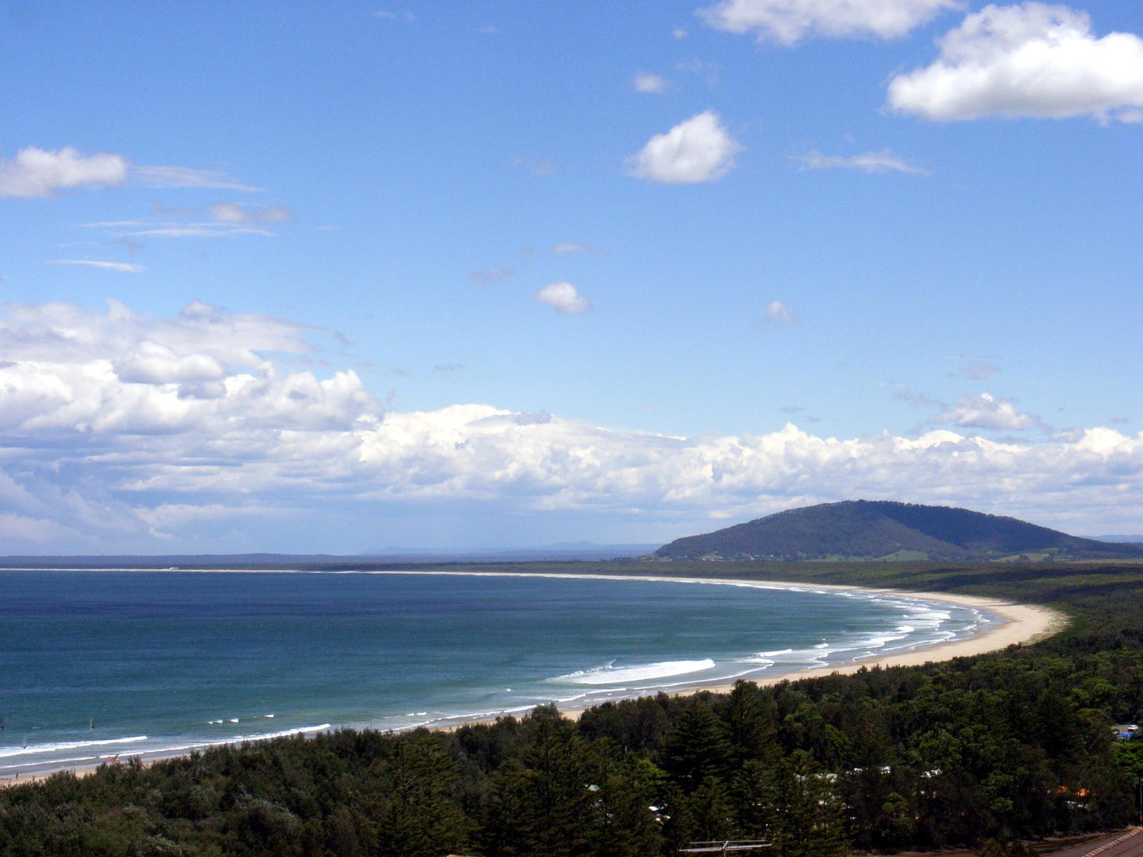
Seven Mile Beach runs just over 12 km from Gerroa to Shoalhaven Heads, almost all of it inside Seven Mile Beach National Park. It is a long, flat surf beach backed by dunes and forest, with free picnic areas and two sand track walks. The Gerroa end, where Crooked River meets the sea, has gentler waves and is where surf schools teach beginners.
Start at the Kingsford Smith Memorial Lookout in Gerroa, which looks over the whole sweep of sand to Mount Coolangatta. NPWS says the park can close in poor weather or high fire danger, so check its alerts page on the day. Allow half a day, or combine it with Gerringong or Berry.
From Kiama Ridge Waters: about a 12-minute drive (10.9 km) to the Gerroa lookout. Read our Seven Mile Beach guide and Gerroa guide.
Seven Mile Beach National Park
Gerroa to Shoalhaven Heads
Just over 12 km of beach. Free picnic areas and sand track walks. Check NPWS alerts before you go.
WebsiteGoogle MapsDirections: Google Maps · Waze
Head inland to the village of Jamberoo
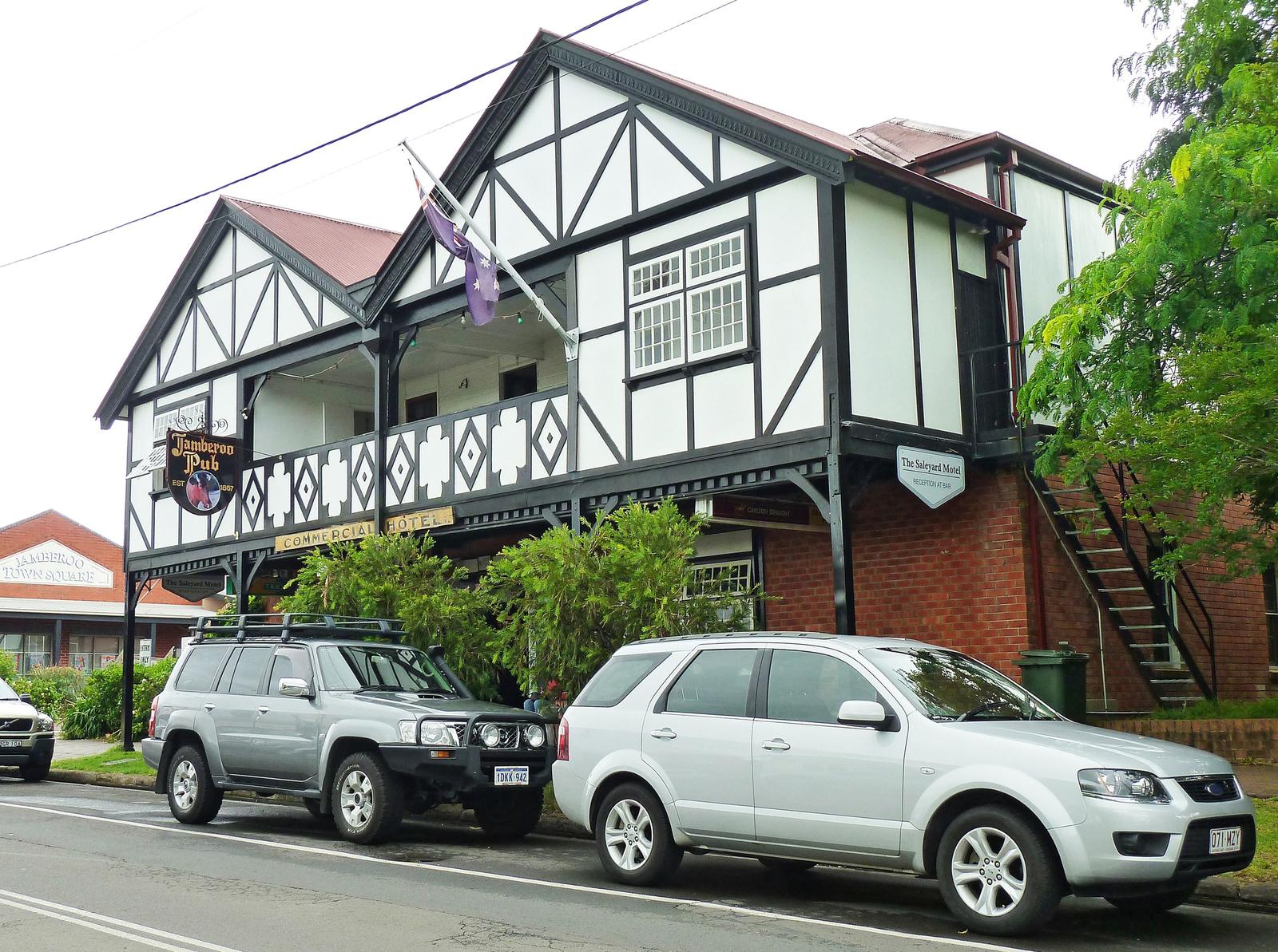
Jamberoo is a small farming village in the green valley under the Illawarra escarpment, a short drive inland from the ocean. Allowrie Street is the main street, with the Jamberoo Pub, built in 1857, a club, a cafe and Reid Park, where the village markets set up on the last Sunday of the month.
Many of the original 19th-century buildings now hold cafes and boutiques. Jamberoo is also the road to Minnamurra Rainforest and Jamberoo Lookout, so it works well as a lunch stop on a hills day. Allow half a day with the rainforest, or an hour or two for the village alone.
From Kiama Ridge Waters: about a 14-minute drive (11 km). See our Jamberoo guide. To stay nearby, read accommodation near Jamberoo.
Jamberoo village
Allowrie Street, Jamberoo
Farming village with the 1857 Jamberoo Pub and markets on the last Sunday of the month.
WebsiteGoogle MapsDirections: Google Maps · Waze
Walk through Minnamurra Rainforest in Budderoo National Park
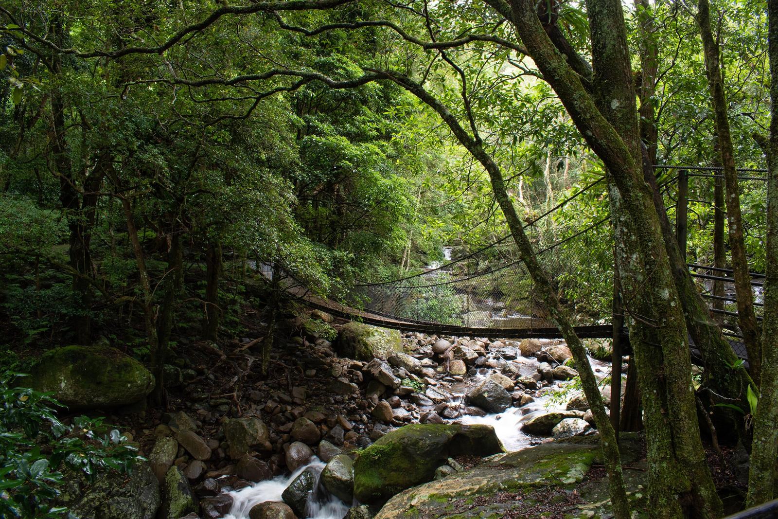
Minnamurra Rainforest is a rare remnant of subtropical and warm temperate rainforest along the upper Minnamurra River, past Jamberoo. Elevated walkways and suspension bridges carry you through it. The Lyrebird Loop is 1.6 km, and the Minnamurra Falls walk is 4.2 km return to platforms over the falls.
NSW National Parks lists the park gates as open 9am to 5pm and the Rainforest Centre as open 9am to 4pm daily, closed Christmas Day. Last access is 3pm for the falls walk and 4pm for the Lyrebird Loop. Entry is $12 per vehicle per day. Dogs are not allowed, except certified assistance animals. The car park can fill, and the centre is sometimes affected by closures, so check the NPWS alerts before you go. Allow 2 to 3 hours.
From Kiama Ridge Waters: about a 25-minute drive (18 km). Read our Minnamurra Rainforest guide, or see waterfalls near Kiama.
Minnamurra Rainforest Centre
345 Minnamurra Falls Road, Jamberoo
Gates 9am to 5pm, centre 9am to 4pm. $12 per vehicle per day. No dogs. Check alerts before you go.
WebsiteGoogle MapsDirections: Google Maps · Waze
Finish with a day in Berry
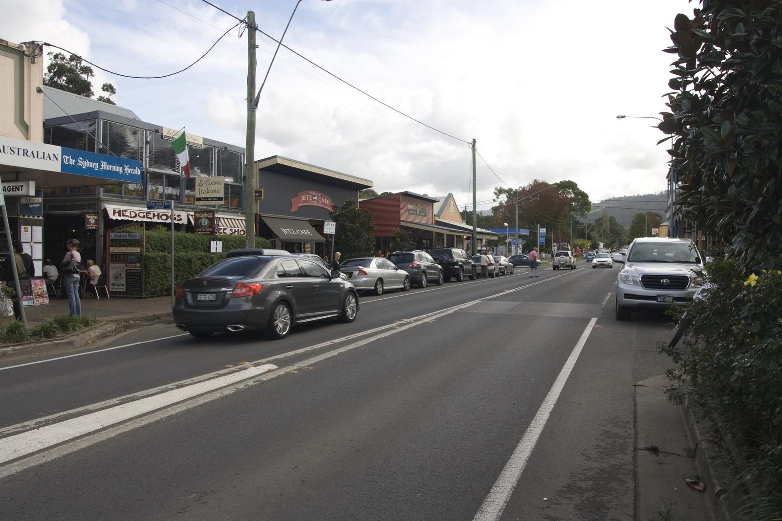
Berry is a heritage country town in the Shoalhaven, just south of the Kiama area, and an easy add-on to any Kiama stay. Queen Street is lined with bakeries, shops and old pubs, and the town has a first-Sunday market and a Thursday farmers' market. Cellar doors sit on the roads around it.
Queen Street gets busy on weekends and market days, so try the side streets if the main strip is full. Berry station is on the South Coast Line, served by a diesel shuttle from Kiama, but it runs less often than the Sydney trains, so check times on Transport NSW. Allow half a day, or a full day with Seven Mile Beach on the way home.
From Kiama Ridge Waters: about a 15-minute drive (20.5 km). Read our Berry day trip guide and day trips from Kiama.
Berry
Queen Street, Berry
Heritage town with bakeries, shops, pubs and markets. About 15 minutes' drive from Kiama Ridge Waters.
WebsiteGoogle MapsDirections: Google Maps · Waze
Plan your 2027 visit around the show, the festival and the whales
A few dates make 2027 a good year to time your trip. All of them are confirmed by the organisers, and details can change, so check before you book.
| When | What | Where |
|---|---|---|
| Friday 22 and Saturday 23 January 2027 | The 179th Kiama Show: cattle and horse events, the Pavilion, sideshow alley and fireworks | Kiama Showground, Bong Bong Street |
| Friday 5 to Sunday 7 March 2027 | Kiama Jazz and Blues Festival, its 40th anniversary. Program and tickets not yet announced | Venues in Kiama, Gerringong and Minnamurra |
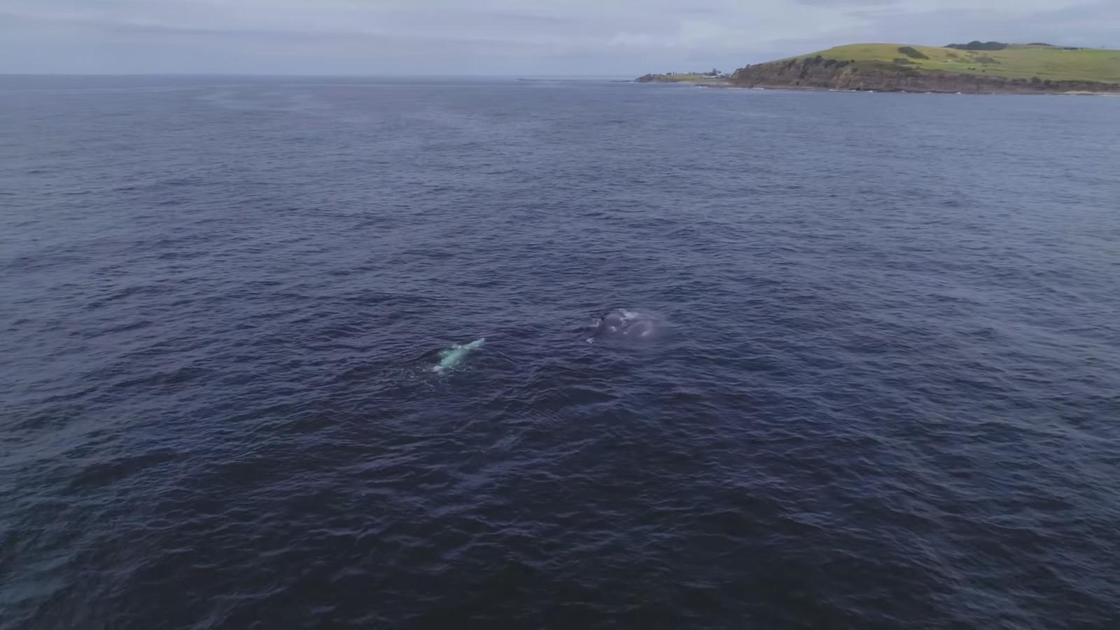
| About May to November | Whale season. Humpbacks head north from late May to July and return south with calves from September to November | Blowhole Point, Bombo Headland, Gerringong platform |
Kiama Show day tickets go on sale online from 1 January 2027. The 2027 show hours have not been published yet. Read our Kiama Show 2027 guide and Kiama Jazz and Blues Festival 2027 guide for updates.
For whales, September to November is the pick, when mothers and new calves often swim closer to shore, and several of the headlands on this list double as free lookouts. See whale watching in Kiama, plus Kiama events and the Kiama weather guide for the rest of the year.
Group the places into three easy days
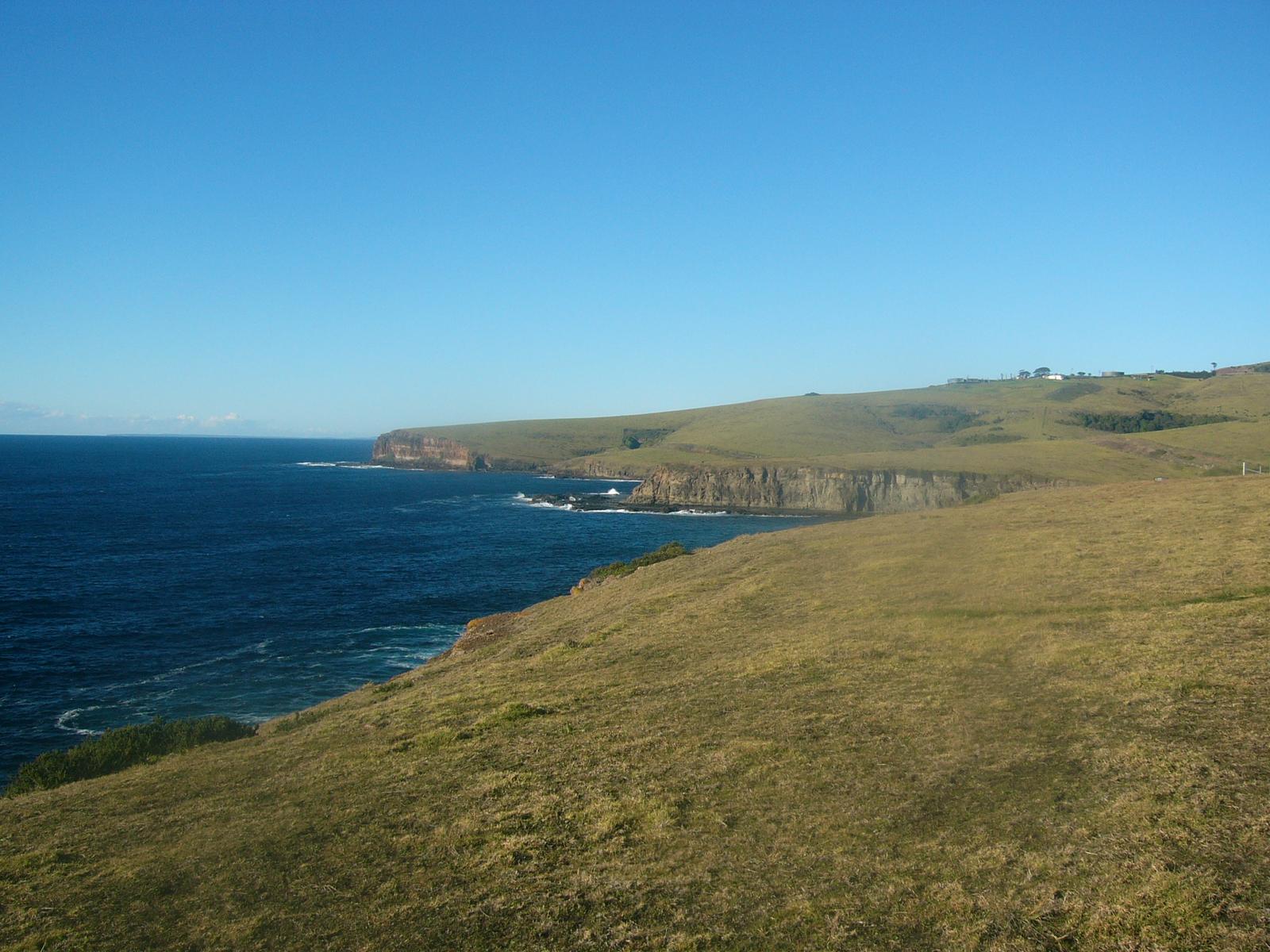
The sights fall into three clusters, so you can see most of this list in a long weekend without doubling back.
- Day 1, town and headlands: walk from the apartments to Easts Beach and the Little Blowhole, then on along the Mid section of the Coast Walk to Kendalls Beach, Surf Beach, the Blowhole, the Lighthouse and the Harbour. Walk back the same way, or leave a car in town.
- Day 2, north coast and hills: sunrise at Cathedral Rocks, then Bombo Headland Quarry, Saddleback Mountain mid-morning and Jamberoo for lunch. Finish at Minnamurra Rainforest before last access.
- Day 3, south: Gerringong and Werri Beach in the morning, the Gerroa lookout and Seven Mile Beach, then Berry for the afternoon.
With children, see things to do in Kiama with kids. On a budget, nearly all of these places are covered in free things to do in Kiama. For parking near each spot, read the Kiama parking guide.
Stay between the town sights and the south coast
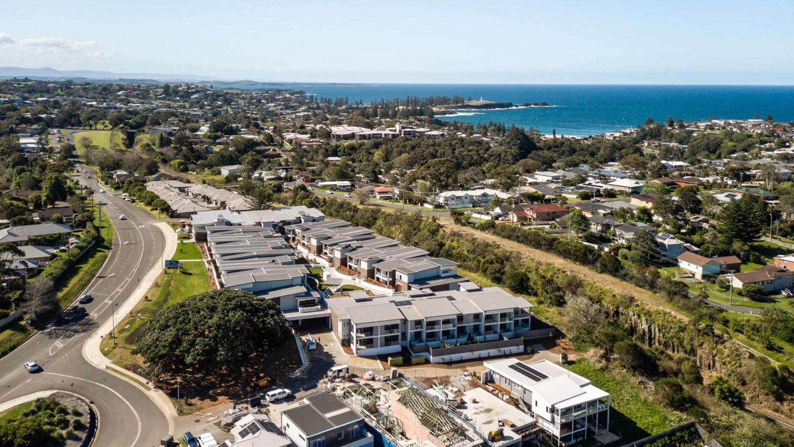
Kiama Ridge Waters puts you a 15-minute walk from Easts Beach, 20 minutes from the Little Blowhole and about 35 minutes on foot from the Blowhole. Gerringong, Saddleback Mountain and Cathedral Rocks are all under 10 minutes by car. Each of the three-bedroom apartments at 2 Surfleet Place sleeps six, with two bathrooms, a full kitchen, a laundry and garage parking for two cars.
Most of our apartments take pets on request ($200 cleaning fee). Check-in is from 3pm and check-out by 10am. Groups can book several apartments on the same site. See our three-bedroom apartments in Kiama, weekend stays in Kiama and group accommodation, or check availability.
Quick answers
What are the top places to visit in Kiama?
Start with the Kiama Blowhole, Kiama Lighthouse and Kiama Harbour, which sit together on Blowhole Point. Add the Little Blowhole, Cathedral Rocks, Bombo Headland Quarry and Saddleback Mountain. Further out, Minnamurra Rainforest, Jamberoo, Gerringong, Seven Mile Beach and Berry are all within 25 minutes' drive.
Are the places to visit in Kiama free?
Almost all of them are. The Blowhole, Little Blowhole, Lighthouse grounds, Harbour, beaches, Coast Walk, Cathedral Rocks, Bombo Headland and Saddleback Mountain cost nothing. Minnamurra Rainforest is the main exception, at $12 per vehicle per day according to NSW National Parks. Check fees before you go.
How many days do you need in Kiama?
Two or three days covers most of this list. Spend one day on the town headlands and the Coast Walk, one on Cathedral Rocks, Bombo, Saddleback, Jamberoo and the rainforest, and one heading south to Gerringong, Seven Mile Beach and Berry. A single day suits Blowhole Point and the town beaches.
Can you see Kiama's sights without a car?
Yes, for the town sights. From Kiama Ridge Waters you can walk to Easts Beach, the Little Blowhole, the Blowhole, the Lighthouse and the Harbour, mostly along the Kiama Coast Walk. Gerringong and Berry have stations on the South Coast Line. Saddleback, Jamberoo and Minnamurra Rainforest need a car.
When is the Kiama Show in 2027?
The Kiama Show Society has set the 179th Kiama Show for Friday 22 and Saturday 23 January 2027 at Kiama Showground on Bong Bong Street. Day tickets go on sale online from 1 January 2027 or at the gate. The 2027 hours have not been published yet, so check before you go.
When is the Kiama Jazz and Blues Festival in 2027?
The organisers have confirmed Friday 5 to Sunday 7 March 2027, the festival's 40th anniversary, after a pause in 2026. It uses venues across Kiama, Gerringong and Minnamurra. The 2027 program, artists and tickets have not been announced yet, so watch the official festival website.
When is whale season in Kiama?
Whales pass Kiama from about May to November. Humpbacks head north from late May to July and return south with their calves from September to November, when they often come closer to shore. Watch for free from Blowhole Point, Bombo Headland or the Gerringong whale-watching platform.
What is the closest sight to Kiama Ridge Waters?
Easts Beach is the closest, about a 15-minute walk (1.3 km) from the apartments at 2 Surfleet Place. The Little Blowhole is about 20 minutes on foot (1.6 km), and the Kiama Blowhole and Lighthouse are about 35 minutes' walk or a 5-minute drive.
Sources and useful links
- Destination Kiama: Kiama Blowhole listing
- Destination Kiama: Little Blowhole listing
- Destination Kiama: Kiama Lighthouse listing
- Destination Kiama: Kiama Harbour listing
- Destination Kiama: Easts Beach listing
- Destination Kiama: Kiama Coast Walk
- Destination Kiama: Bombo Headland listing
- Destination Kiama: Cathedral Rocks listing
- Destination Kiama: Saddleback Mountain
- Destination Kiama: Jamberoo
- Destination Kiama: Gerringong
- Destination Kiama: Werri Beach and Point
- Destination Kiama: Whale watching
- NSW National Parks: Minnamurra Rainforest Centre
- NSW National Parks: Seven Mile Beach National Park
- BeachSafe: Easts Beach
- BeachSafe: Werri Beach
- NSW Government: Kiama Blowhole
- Kiama Coast Holiday Parks (Kiama Council): Kiama Blowhole
- Visit NSW: Berry
- Kiama Show Society
- Kiama Jazz and Blues Festival
- Transport NSW trip planner